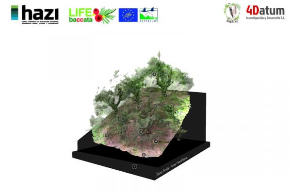
3D high-precision mapping results of yew forests at Sarastarri (Aralar Nature Park) and at Zezen Erreka (Pagoeta Nature Park) in the Basque Country were published
22-01-2019

As part of the LIFE BACCATA Project, the characterization of forestry formations with yew trees in Aralar and Pagoeta (Gipuzkoa, Spain) was conducted. The survey included the 3-D high-precision land photogrammetric mapping of the plots which are representative of these spaces. Thanks to this, some parameters were computed, such as size, structure, species distribution and the surveyed area condition.
The conducted mapping practices combined some techniques, such as automated digital photogrammetry, remote sensing, and Geographic Information Systems (GIS). Photos of the forestry plots were taken with a 3-axis camera stabilizer (Osmo, a trademark of DJI) connected to a 5-meter road and with a tablet with DJI Go software that allows capturing images remotely. Over 1,300 photos were taken of plots of an area that ranges from 400 to 500 m2 and its resulting orthophotography resolution was up to 1-5 cm. In addition a 3D model was used with over 17 million dots in each case.
The Sarastarri plot is located in a hillside on the North of Lareo Reservoir, in Aralar. It is covered with beech forests, with the outstanding presence of yew and holly trees. Its soils feature the emergence of some limy rock in the shape of outcropped lapies, although areas interspersed by deep and well-developed soils abound.
In the case of Zezen Erreka, within the Pagoeta Nature Park, the plot is made up by a pruned beech forest that includes yew trees. Its soils, which are further developed, have no outcropped rock and its herbaceous canopy is less developed due to the reduced availability of the sun light.
Thanks to both mapping practices its fine characterization was achieved. This will allow us to compare the surveyed parameters in the future and therefore to assess the evolution of both enclaves across time.
The photogrametric mapping was carried out by the companies Bioma Forestal and 4Datum Investigación y Desarrollo S.L. under the supervision of Hazi Fundazioa, the Project Partner, and with the collaboration of the Gipuzkoa Provincial Council, the Manager of both Nature Parks.
Modelo de Sarastarri (PN Aralar)
The conducted mapping practices combined some techniques, such as automated digital photogrammetry, remote sensing, and Geographic Information Systems (GIS). Photos of the forestry plots were taken with a 3-axis camera stabilizer (Osmo, a trademark of DJI) connected to a 5-meter road and with a tablet with DJI Go software that allows capturing images remotely. Over 1,300 photos were taken of plots of an area that ranges from 400 to 500 m2 and its resulting orthophotography resolution was up to 1-5 cm. In addition a 3D model was used with over 17 million dots in each case.
The Sarastarri plot is located in a hillside on the North of Lareo Reservoir, in Aralar. It is covered with beech forests, with the outstanding presence of yew and holly trees. Its soils feature the emergence of some limy rock in the shape of outcropped lapies, although areas interspersed by deep and well-developed soils abound.
In the case of Zezen Erreka, within the Pagoeta Nature Park, the plot is made up by a pruned beech forest that includes yew trees. Its soils, which are further developed, have no outcropped rock and its herbaceous canopy is less developed due to the reduced availability of the sun light.
Thanks to both mapping practices its fine characterization was achieved. This will allow us to compare the surveyed parameters in the future and therefore to assess the evolution of both enclaves across time.
The photogrametric mapping was carried out by the companies Bioma Forestal and 4Datum Investigación y Desarrollo S.L. under the supervision of Hazi Fundazioa, the Project Partner, and with the collaboration of the Gipuzkoa Provincial Council, the Manager of both Nature Parks.


